
Climate
The coast.
Precipitation along the coast increases southward from Rio de Janeiro (Highest: 150mm/month in November-February, lowest: less than 50mm/month in June to August) to Parati-Santos (Total:2300mm/year, highest:300mm/month in October-March, lowest 70mm/month in June). Temperatures in the northern coastal lowlands rarely exceed 27°C or drop below 20°C.
Further south along the coast both temperatures and precipitation decrease. At the southern limit (north of Curitiba with 1400mm precipitation per year) precipitation is usually not more than 100mm/month, peaking December-February at about 200mm/month. Temperatures stay around 20°C, and can drop to 10°C in June to August.
The mountains.
At the higher altitudes of the Serra Mantiqueira and Serra Bocaina annual precipitation is about the same as at the coast but with a greater range (e.g. highest: 400mm/month in November-March and minimal precipitation in June, July and August (25mm/month)). Temperatures are normally around 15°C, but can drop as low 5°C in July and August.
Inland.
São Paulo at an altitude of 740 meters on the Altiplano has an annual average precipitation of 1270mm/year rarely exceeding 230mm/month with the driest period being May-September (less than 40mm/month). Further inland on the Altiplano precipitation decreases.
see also the data for Fazenda Intervales, Nucleo Sta. Virginia and Parqueria-Abaixo.
Images and recordings on this page
-
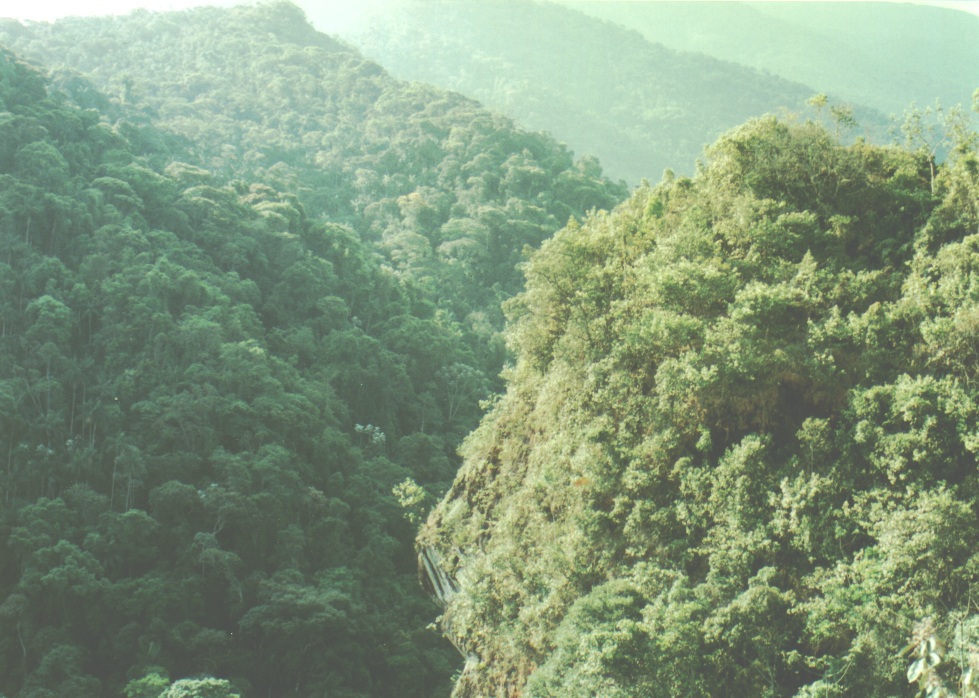
Primary/secondary Atlantic rainforest. Nucleo Sta. Virginia, near Ubatuba -
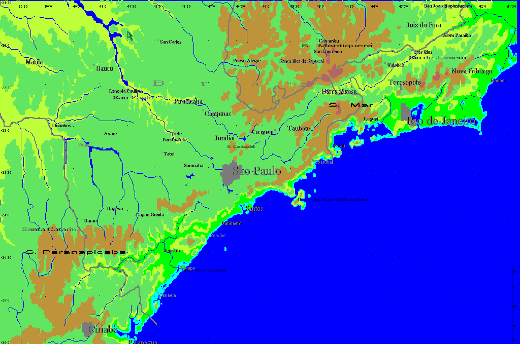
Area Map
-
Phaethornis eurynome, Parco Estadual Jacupiranga, Caverna do Diabo, 10/23/94. Cloudy, 25°C. With Procnias nudicollis.
Where these come from
The work names each item by a file stem in its own caption records. The captions above are those records with the stem and its separators removed; where an item sat on the original page was not recorded and is not guessed.
- A36 original-cd/CD01/SEBrazil/PICTURE/A36.JPG
- c05da526 original-cd/CD01/SEBrazil/PICTURE/C05DA526.BMP
- 441011 original-cd/CD01/SEBrazil/WAV/441011.wav
This page on the other discs
Disc 2 · 2001
Climate · page 5 of that disc
The coast.
Precipitation along the coast increases southward from Rio de Janeiro (Highest: 150mm/month in November-February, lowest: less than 50mm/month in June to August) to Parati-Santos (Total:2300mm/year, highest:300mm/month in October-March, lowest 70mm/month in June). Temperatures in the northern coastal lowlands rarely exceed 27°C or drop below 20°C.
Further south along the coast both temperatures and precipitation decrease. At the southern limit (north of Curitiba with 1400mm precipitation per year) precipitation is usually not more than 100mm/month, peaking December-February at about 200mm/month. Temperatures stay around 20°C, and can drop to 10°C in June to August.
The mountains.
At the higher altitudes of the Serra Mantiqueira and Serra Bocaina annual precipitation is about the same as at the coast but with a greater range (e.g. highest: 400mm/month in November-March and minimal precipitation in June, July and August (25mm/month)). Temperatures are normally around 15°C, but can drop as low 5°C in July and August.
Inland.
São Paulo at an altitude of 740 meters on the Altiplano has an annual average precipitation of 1270mm/year rarely exceeding 230mm/month with the driest period being May-September (less than 40mm/month). Further inland on the Altiplano precipitation decreases.
see also the data for Fazenda Intervales, Nucleo Sta. Virginia and Pariqueria-Abaixo.
Disc 3 · 2006
This disc carries the same wording as shown above.
Source details
- Release
- Disc 1 · 2011
- Recovered title
- Climate
- Source location
- original-cd/CD01/SEBrazil/DOCS/Discussn.dat:record=5,offset=320; original-cd/CD01/SEBrazil/DOCS/Sebrazil.dfd:nul_segments=35-41
- Decoded text
- recovered-front-matter-release-aware-v0.1/releases/CD01/INTRODUCTION_TEXT/05.txt
- Page boundaries
- derived from the accepted CD03 boundaries by index-title correspondence plus mechanical segment-stream alignment (CD03 136 segments -> CD01 131 segments); closed by contiguity. This is a provisional sequence: the pages are numbered and titled exactly as the disc's own index records them, but the division of the running text into pages is inferred by this project from the ordered content. The original program's page-link bytes were never decoded, so this is the best-supported order available, not a proven reproduction of the original page flow.
- Text status
- Decoded from the preserved bytes: each byte is one CP1252 character, code point = byte + 31. The work's own markup (font and colour changes, line breaks, scientific-name markers, reference citations) is rendered rather than shown as codes. No spelling, punctuation or typography has been changed.
- Encoding record
- front-matter-encoding-recovery-v0.1